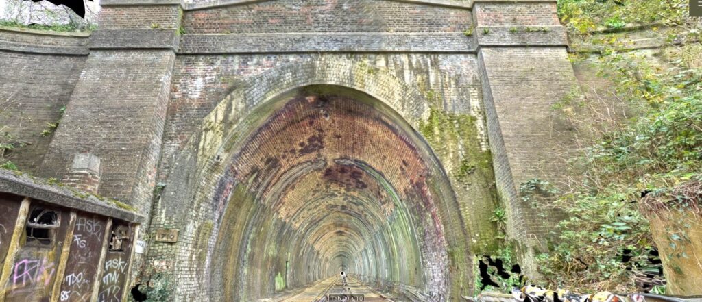
Click on "+" to expand survey materials
Scantech received a phone call in the morning asking for us to attend the site in Pontefract as there had been a Landslip.
A Laser scan of the slip to provide sections was required.
A drone was also used to create a model of the slip.
Scantech attended site to carry out the laser scan which was successfully carried out.
Matt Brewer from Network Rail flew a drone over the site for us so that we were able to create a model from the images.
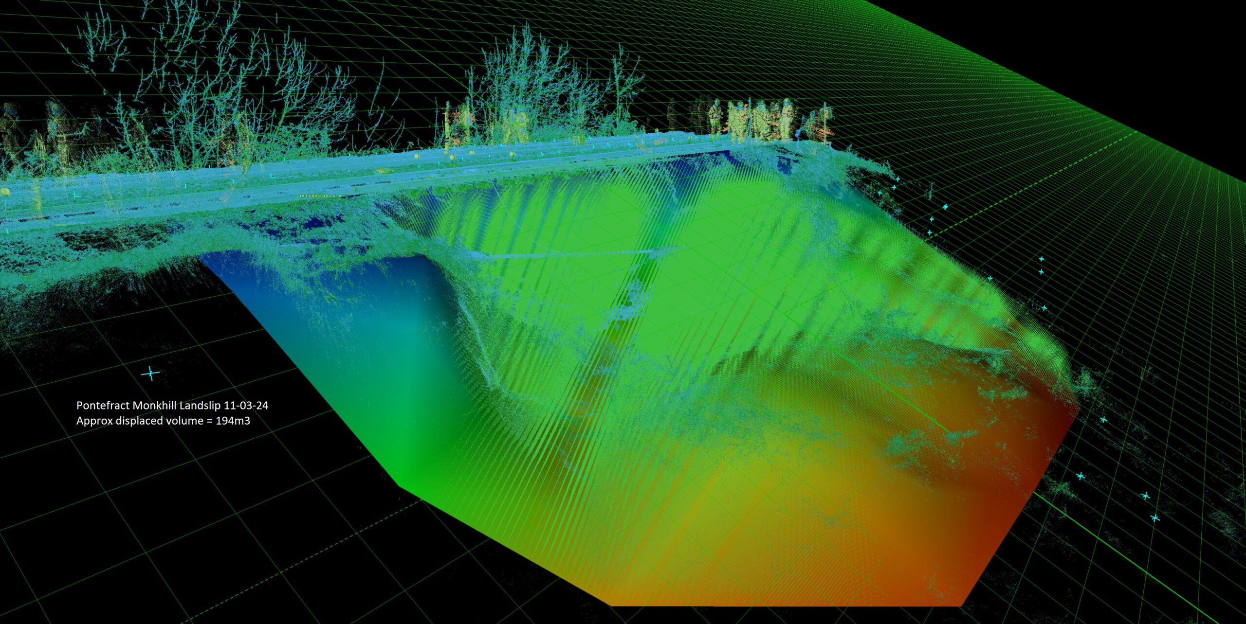
Continued monitoring survey of the landslip and bridge located at Monkhill in Pontefract.
Josh Brazil and Tom Davis carried out the survey using our Leica RTC360.
Continued monitoring survey of the landslip and bridge located at Monkhill in Pontefract.
David McCrory flew our Matrice350 with L2 laser scanner attached to it.
Continued monitoring survey of the landslip and bridge located at Monkhill in Pontefract.
Jonathan McCrory carried out the monitoring survey using our Leica RTC360.
David McCrory flew the Matrice 350 with L2 laser scanner attach over the site.
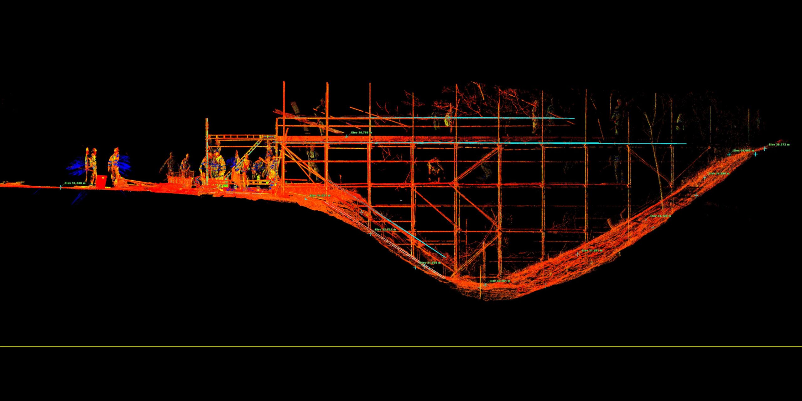
Continued monitoring survey of the landslip and bridge located at Monkhill in Pontefract.
Jonathan McCrory carried out the scanning of the scaffolding bridge using out Leica RTC360 laser scanner.
Continued monitoring survey of the landslip and bridge located at Monkhill in Pontefract.
Josh Brazil and Tom Davis carried out the monitoring survey using our Leica RTC360.
Continued monitoring survey of the landslip and bridge located at Monkhill in Pontefract.
Josh Brazil and Tom Davis carried out the monitoring survey using our Leica RTC360.
Continued monitoring survey of the landslip and bridge located at Monkhill in Pontefract.
Josh Brazil and Tom Davis carried out the monitoring survey using our Leica RTC360.
Continued monitoring survey of the landslip and bridge located at Monkhill in Pontefract.
Josh Brazil and Tom Davis carried out the monitoring survey using our Leica RTC360.
Continued monitoring survey of the landslip and bridge located at Monkhill in Pontefract.
Josh Brazil and Tom Davis carried out the monitoring survey using our Leica RTC360.
David McCrory flew the Matrice 350 with L2 laser scanner attach over the site.
To request additional or different data, please complete the following form and our team will be in touch.
For more information regarding the above data please contact info@scantech-international.com or call 01625 260 446
This data is accurate on the date of survey indicated. Scantech International Ltd are not liable for any changes that might occur.
To request additional or different data about a location, please complete the following form and our team will be in touch.